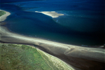
A00056C Tain to Tarbat Ness

This peninsula is located northeast of Inverness along the east coastline of Scotland. Photographed during a prolonged Arctic winter spell, heavy frost has formed down to the sea shores of the Dornoch Firth. The settlement of Tain lies in the bottom right of the picture next to the River Tain outlet. The coastline runs up the picture to the tip of Tarbat Ness lighthouse, to a location which was the site of a Norse and Scots battle. A WWII aerodrome was constructed on the lands in the middle of the picture. Post the war it became an aerial firing range.
Viewed looking southeast.
OS: 57.819296 -4.05156
Viewed looking southeast.
OS: 57.819296 -4.05156

|