A00689I Lud Castle, Gaylet Pot and Castlesea Bay
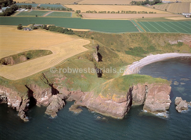
Location, 2 miles north of Arbroath town and one mile south of Auchmithie coastal village on the east coast of Scotland. A sandstone promontory projects from a line of sea cliffs south of Auchmithie known as "Lud Castle". It was the site of an Iron Age fortification almost surrounded by over 100 ft sea cliffs. Connected by a short sloping rampart it overlooks Castlesea Bay just above the fort in the picture which is to the north in the direction of Auchmithie. To the far left of the sea cliff fort lies Gaylet Pot blow hole in the middle of a field. It was naturally formed over a long period of time by the sea eroding the weaknesses of the coastal rock. A cavern eventually spread inland until the ceiling collapsed. A coastal path weaves it way from Auchmithie to Lud Castle and continues south to Arbroath.
Viewed looking north west.
OS: 56.580284 -2.519891
Viewed looking north west.
OS: 56.580284 -2.519891

|