A00207C Lud Castle and Gaylet Pot
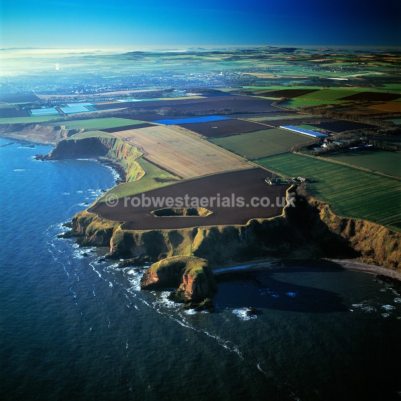
Location, 2 miles north of Arbroath on the east coast of Scotland. An eroded sandstone platform projects from a line of sea cliffs under one mile south of Auchmithie coastal village. The crumbled projection called "Lud Castle" was the site of an Iron Age fortification and sits on top of 100 ft sea cliffs. Connected by a short sloping rampart it overlooks Castlesea Bay on the right of the picture. In the picture just above the promontory fort lies Gaylet Pot blow hole in the middle of a ploughed field. The hole was naturally formed over a long period of time by the sea eroding the weakness of the soft coastal rock. A cavern eventually spread inland from the sea until the ceiling eventually collapsed.
Viewed looking southwest.
OS: 56.582151 -2.51964
Viewed looking southwest.
OS: 56.582151 -2.51964

|