A00019B Loch Etive
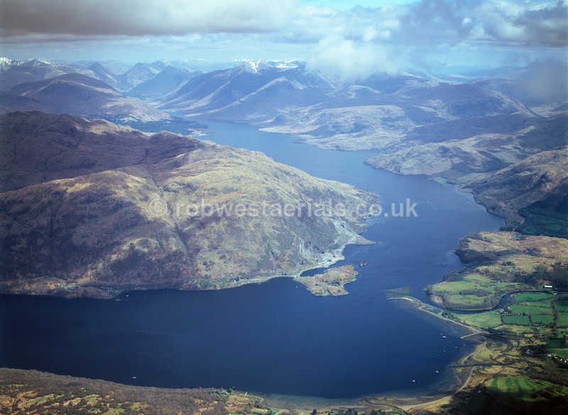
A sea loch stretching from the "Falls of Lora", off to the left of the picture, which travels east before doglegging northeast into a mountainous region reaching its most northern point at "Glen Etive" (top left). During the 1800's ships from Oban ran the length of the loch on sightseen cruises stopping at Glen Etive pier where visitors went on by carriage to see Glen Coe. Viewed looking northeast from above Taynuilt.
OS: 56.436752 -5.264569
OS: 56.436752 -5.264569

|